


With growing access to satellite imagery, new opportunities emerge to better understand and address the environmental devastation caused by armed conflicts. In response to this juncture, NASA Lifelines aims to improve knowledge sharing among humanitarians and earth observation experts on the use of remote sensing data.
The program’s mission is to bring together experts from different sectors, countries, and backgrounds to improve humanitarian response and support for affected communities. In a new partnership with NASA Lifelines, PAX will take up a role as one of their Humanitarian Wayfinders to build a network of humanitarians, environmentalists, remote sensing specialists, and partners from conflict-affected countries. The work will also involve sharing knowledge and methods on how to apply analysis from publicly available satellite data to understand how wars and the climate crisis impact the environment people depend upon.
With a wealth of satellite data available for people to use, this collaboration aims to pave the way for broader access and use of this data, facilitating researchers and people from affected communities to make effective use of these tools and imagery. PAX believes that the sharing of best practices, methods, and sources can lead to a democratisation of knowledge, and help moving forward a broader environmental lens on humanitarian response in areas affected by armed conflicts. NASA’s massive network of experts, data scientists, and experience is a valuable resource for the humanitarian and environmental community to tap into and make use of.
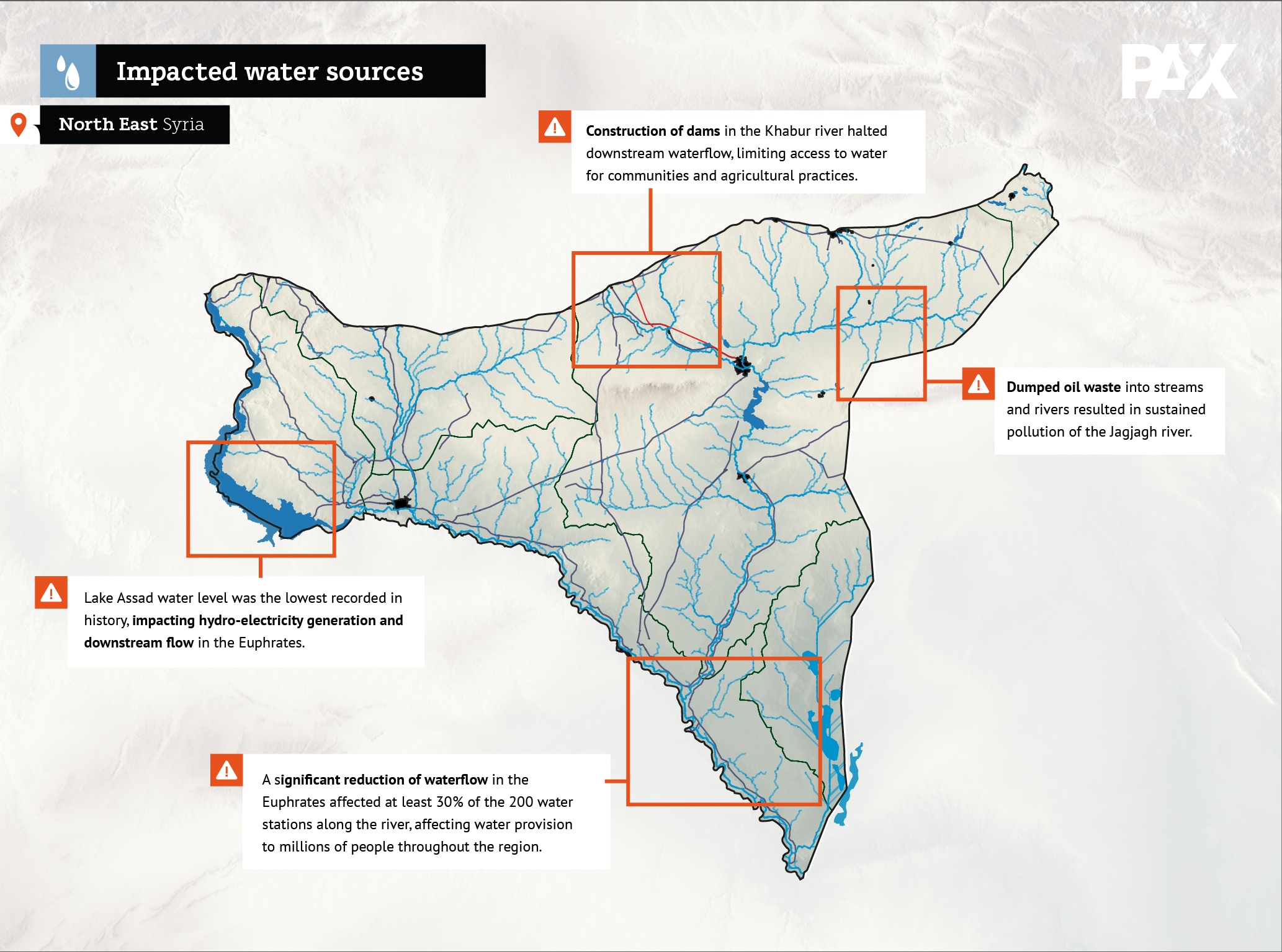


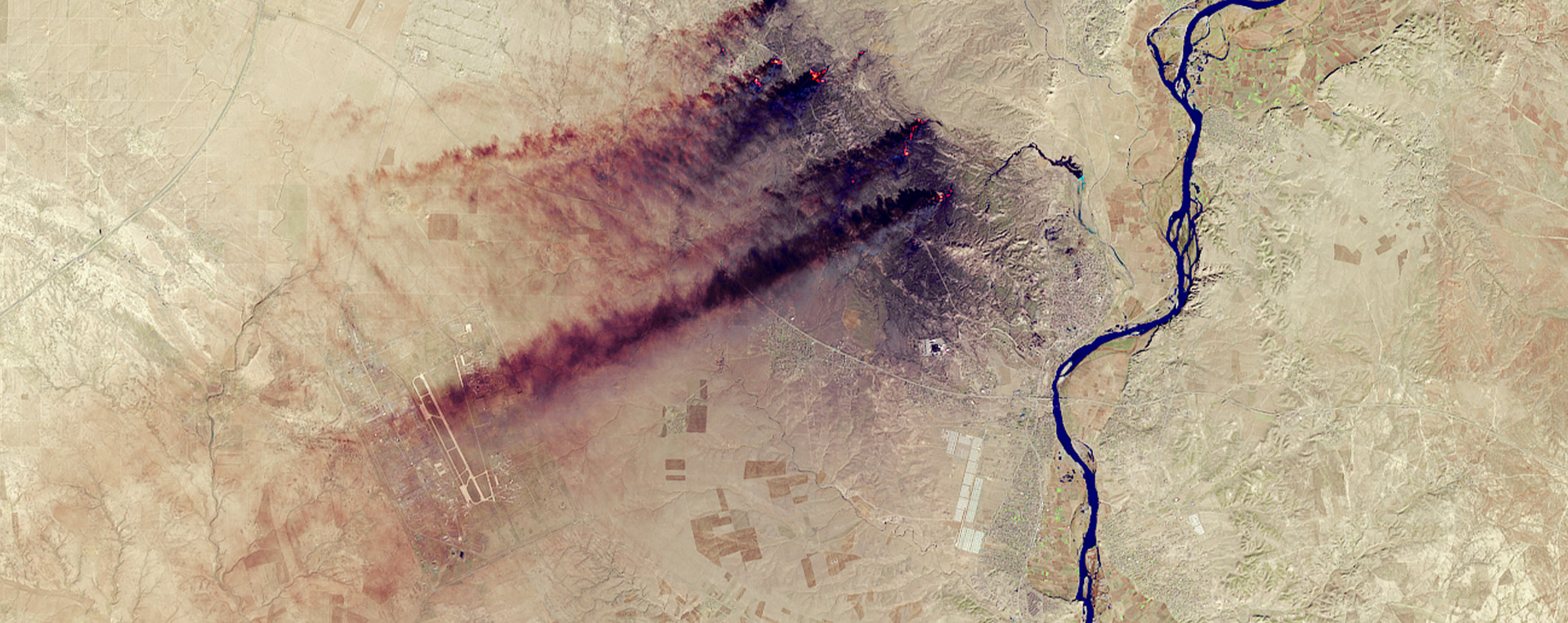
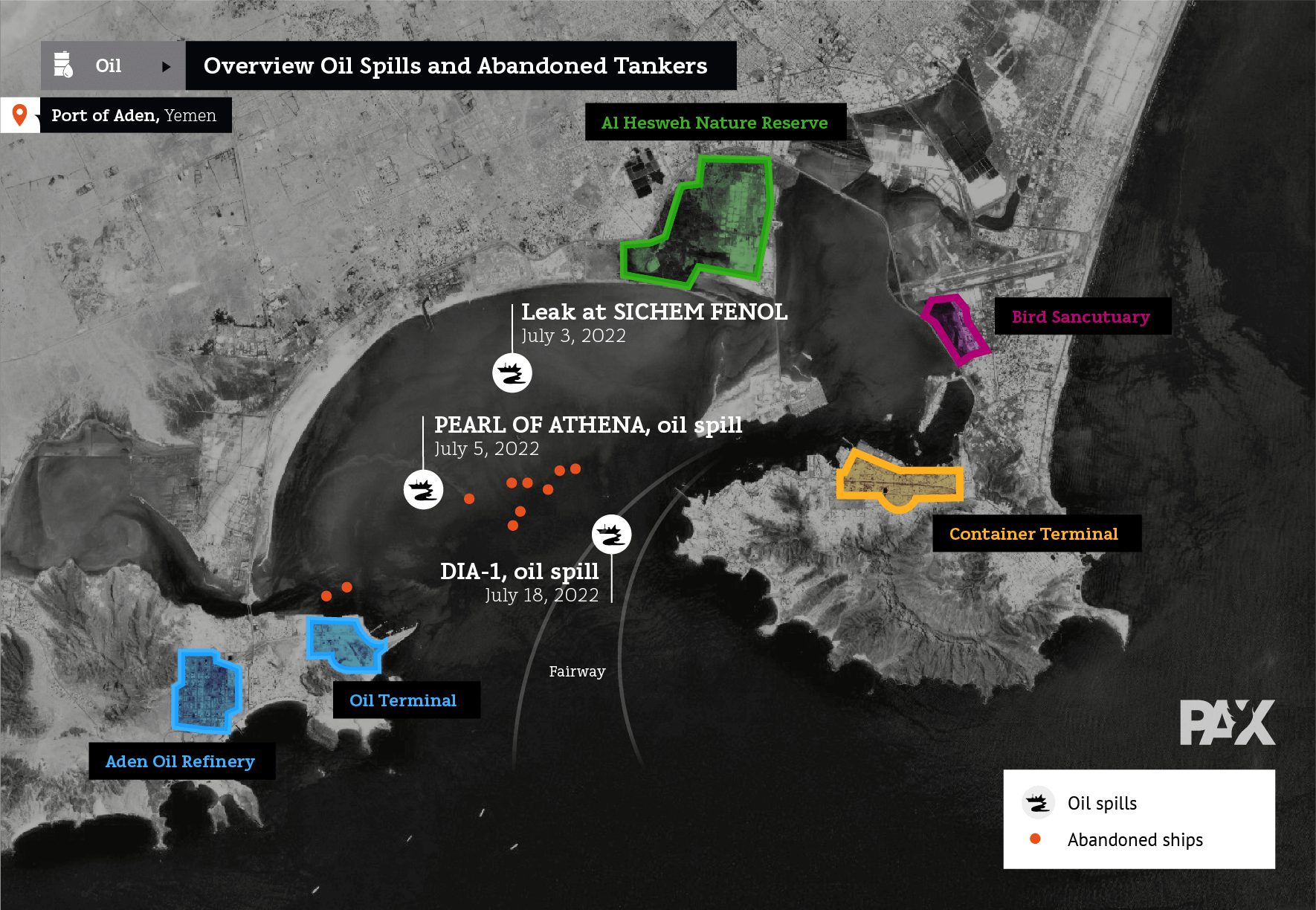
PAX has been pioneering the use of satellite imagery in its work to highlight the environmental consequences of wars, starting in Syria in 2015 by highlighting the risks of urban damage and toxic remnants of war, followed by an in-depth analysis of makeshift refineries in the east of the country. The work is currently applied to a range of war zones, including Ukraine, Iraq, South Sudan, Yemen, and Libya, often in collaboration with partners on the ground. The findings have been used by UN organisations, journalists, and humanitarian organisations to document and respond to environmental damages of conflicts. Much of the work and learning experience is owed to the broader open-source community that has been of inspiration and support to PAX’s work, most notably the initial publications with Bellingcat and later through collaboration with the Centre for Information Resilience on Ukraine.
As a first step within the Humanitarian Wayfinders program, PAX has begun strengthening connections with academic actors by engaging in a Pathways for Sustainability research project with Utrecht University. This interdisciplinary research examines the political, ethical, and methodological possibilities and concerns arising from the use of satellite imagery, asking how these new ways of seeing and documenting environmental harms add to our understanding of ecological violence in conflict-affected regions.
As part of the work on this program, PAX also supports Utrecht University’s expansion of the emerging ‘Green Conflict Studies’ and their work on understanding the climate-conflict nexus and how environmental issues and challenges impact or are impacted by violent conflict and inequalities. This year’s Wayfinders Program also includes organizations such as Save the Children, the World Food Program, and the International Centre for Diarrhoeal Disease Research in Bangladesh.
For more information: Wim Zwijnenburg zwijnenburg@paxforpeace.nl